
Japanese Earth-observation company Synspective has released the first imagery captured by its 12th StriX synthetic-aperture-radar satellite, offering an early look at the spacecraft’s performance after its September launch. The company said the preliminary test data includes observations of Rio de Janeiro and Perth on November 9, plus an image of Tokyo acquired on November 8. The release on November 12 is a commissioning milestone, not a declaration that the satellite has entered full commercial service. The images were captured while engineers continue functional testing and calibration.
First imagery marks a step from launch to operation
Synspective announced on November 12 that it had successfully acquired imagery from its 12th synthetic-aperture-radar satellite. The company said the images are preliminary test data captured during functional testing and calibration. Two observations, over Rio de Janeiro and Perth, were acquired on November 9 using the Staring Spotlight mode. A third, over the company’s Tokyo headquarters area, was acquired on November 8 using the Sliding Spotlight mode.
The distinction between first imagery and full operations is important. A satellite can reach orbit and deploy its antennas, but the mission is not finished when it begins sending data. Engineers need to verify that the spacecraft is healthy, that the radar instrument is functioning as expected, that pointing and timing are correct and that the data-processing chain can turn raw measurements into usable products. Calibration helps ensure that the images can be interpreted consistently and that measurements are reliable enough for customers and analysts.
Synspective described the released data as preliminary. It should therefore be treated as evidence that the satellite has begun imaging, not as proof that every commercial product is ready or that the spacecraft has already reached its final operational performance. The first images are useful because they demonstrate that the radar is collecting data from different parts of the world and that engineers can evaluate more than one observation mode during the commissioning period.
How the satellite reached orbit
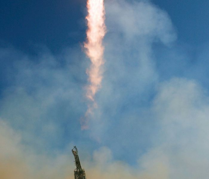
The spacecraft launched on September 19, 2026, at 03:22 UTC from Rocket Lab Launch Complex 1 on the Mahia Peninsula in New Zealand. Rocket Lab’s Electron rocket delivered the 12th StriX satellite to a low-Earth orbit at an altitude of 572 kilometres, according to the launch provider. The mission was named “Owl By The Dozen”, a reference to the growing StriX constellation and its radar-imaging purpose.
Electron is designed for dedicated small-satellite missions. That matters to constellation operators because a spacecraft can be deployed into a selected orbit rather than waiting for a larger rideshare mission to provide a suitable slot. For Synspective, a dedicated launch also supports the gradual expansion of a fleet in which each satellite is expected to contribute to repeated observations of the same regions. The September mission was Rocket Lab’s 12th launch for Synspective’s radar constellation, according to the company’s mission record.
StriX is a compact satellite platform. Synspective describes the spacecraft as a 100-kilogram-class satellite with an X-band radar instrument operating at a centre frequency of 9.65 gigahertz. The published platform specifications are not a measurement of the November test images, but they help explain the engineering approach: a relatively small spacecraft carries an active radar sensor and a deployable antenna to collect detailed observations of Earth’s surface.
Why synthetic aperture radar is different from a camera
Optical satellites record sunlight reflected from the surface or, in some cases, thermal radiation emitted by objects. Their images can be affected by cloud, haze, darkness and the angle of illumination. Synthetic aperture radar works differently. The satellite transmits microwave pulses toward the ground and measures the signals that return. By combining measurements collected as the spacecraft moves along its orbit, the system synthesises a much larger antenna aperture than the physical antenna alone would provide.
Because radar supplies its own illumination, it can collect data at night. Microwave signals can also pass through clouds and are less affected by ordinary weather than visible light, although heavy rain and atmospheric conditions can still affect some radar bands and products. Radar images are not simply photographs in black and white. Their brightness and texture depend on how the surface scatters the signal, which can be influenced by material, roughness, moisture, shape and viewing geometry.
This makes SAR valuable for observing changes that may be difficult to detect with optical imagery. It can help identify ground movement, changes in water extent, damage to infrastructure, shifts in coastal areas and other patterns that affect how a surface reflects radar. Analysts can compare observations taken at different times to detect deformation or changes in land cover. The usefulness of a particular image depends on calibration, viewing angle, resolution and the question being investigated.
Three imaging modes serve different purposes
Synspective’s StriX platform offers several imaging modes, including Stripmap, Sliding Spotlight and Staring Spotlight. Each mode balances the size of the area observed against the level of detail that can be extracted. Stripmap mode is designed for longer continuous coverage. The radar beam follows the satellite’s motion at a relatively steady angle, producing a broader strip of data that can be useful when an operator wants to observe a large region.
Sliding Spotlight mode steers the antenna beam during data collection so that a selected area remains illuminated for longer. That allows the system to gather more information from the target and can improve spatial resolution, while covering a smaller scene than a broad stripmap observation. Staring Spotlight concentrates the observation on a smaller area by keeping the beam focused on the target region for longer. The company describes it as a mode that can provide finer azimuth resolution.
The first images from the 12th satellite show both Staring Spotlight and Sliding Spotlight use. That is useful during commissioning because engineers can test the instrument in more than one configuration. It also demonstrates how a single radar satellite can support different observation needs. A broad-area scan may be appropriate for monitoring a region, while a focused observation can be more useful for examining a specific port, airport, construction site or urban district.
What the first images show and what they do not
Synspective listed three observation locations. Rio de Janeiro and Perth were imaged on November 9 using Staring Spotlight, while Tokyo was observed on November 8 using Sliding Spotlight. The company’s release shows the data as part of a technical first-light announcement. It does not claim that the images are a complete operational product, nor does it report that they have been used to confirm a disaster, identify a new structure or measure a specific change on the ground.
That restraint matters because radar images require interpretation. A bright feature can reflect the shape and material of an object, the angle at which the radar signal reaches it or the way the surface scatters energy. A dark feature may indicate low backscatter, shadowing or a different surface condition. Without the appropriate calibration and reference data, it is easy to mistake an image texture for a physical change. The company’s description of the images as test data is therefore an important qualifier.
The first-light release also does not mean that the satellite is already delivering the same level of performance as an established operational spacecraft. Commissioning can involve repeated checks of the instrument, antenna deployment, pointing accuracy, power, thermal control, downlink and data processing. The satellite must also demonstrate that it can collect observations consistently over time. A successful first image is an encouraging milestone, but it is only one part of that process.
Why a larger radar constellation matters
A single satellite can observe only a limited portion of Earth during each orbit. A constellation of satellites can increase the frequency with which a location is revisited and provide more opportunities to collect data under suitable conditions. For customers monitoring infrastructure, land movement or disaster impacts, revisit frequency can be as important as image detail. A satellite that produces a very sharp image but returns only rarely may be less useful for tracking a rapidly changing situation than a system that provides regular observations.
Synspective has positioned StriX as part of a broader Earth-monitoring service. The company lists applications that include land displacement monitoring, flood damage assessment, disaster damage assessment, offshore wind and wave monitoring, forest inventory management and object detection. These are potential use cases for radar data and analytics, not proof that every application is already supported by the new satellite’s first test images. Each requires its own processing, validation and ground-truth information.
Repeated observations can be especially useful when clouds obscure an area for several days or when an emergency occurs at night. Radar can provide a view of surface conditions when optical satellites cannot collect a clear image. It can also support comparisons before and after an event. However, the data must be processed and interpreted by specialists, and it may need to be combined with optical imagery, field reports, weather data and other sources before a decision is made.
Commercial value depends on calibration and data quality
For a commercial satellite operator, the first image is a technical achievement, but customers ultimately pay for reliable information. That means the company must demonstrate stable instrument performance, predictable delivery, consistent geolocation and products that meet the needs of users. A radar image can be technically impressive and still require significant processing before it becomes useful for an infrastructure manager, insurer or disaster-response agency.
Calibration is part of that process. Engineers compare measurements with known references, assess the stability of the instrument and correct for effects that could distort the final image. They also need to confirm that the satellite’s attitude and orbit are accurately known, because even a small pointing or timing error can shift features in the resulting data. The work continues after the first successful observation, and the results may lead to adjustments in how the spacecraft is operated.
The company’s constellation strategy also depends on production and launch capacity. Rocket Lab has remained a launch partner for Synspective, with additional dedicated Electron missions booked to support future deployment. The two companies have built a repeated launch relationship, which can help the operator plan satellite additions and maintain a consistent spacecraft architecture. But the commercial value of the network will depend on the full service, from launch and commissioning through data delivery and customer support.
What comes next for StriX-12
The next phase is the completion of functional testing and calibration. Synspective will need to confirm that the satellite can continue collecting data across its observation modes and that the results meet the company’s performance requirements. The first images from Rio de Janeiro, Perth and Tokyo provide a starting point for that work. Further test observations can help establish how the instrument behaves over different surfaces and under different viewing conditions.
Once commissioning is complete, the satellite can contribute to the wider StriX constellation and the company’s commercial data services. The timing of that transition depends on the results of the checks, not simply on the date of the first image. The November 12 announcement is therefore best understood as a milestone in the satellite’s path to service rather than a final declaration that the mission is complete.
For the Earth-observation sector, the release is another example of how small commercial satellites are being used to build specialised radar constellations. The images show that StriX-12 has begun its imaging work after the September launch. The harder test now is operational consistency: whether the spacecraft can collect dependable data, whether the company can process it quickly and whether users can turn those observations into decisions about land, infrastructure and environmental change.
Frequently asked questions
What is StriX-12?
StriX-12 is Synspective’s 12th StriX synthetic-aperture-radar satellite. It launched on September 19, 2026, aboard Rocket Lab’s Electron rocket from New Zealand and reached a low-Earth orbit at about 572 kilometres.
Where were the first images captured?
Synspective reported observations of Rio de Janeiro and Perth on November 9 using Staring Spotlight mode, and Tokyo on November 8 using Sliding Spotlight mode. The company described them as preliminary test data collected during calibration.
Can a SAR satellite image Earth at night and through clouds?
Yes. SAR uses its own microwave illumination rather than relying on sunlight, and microwaves can pass through many clouds. The exact quality of an image still depends on the radar band, weather, surface conditions and processing.
Sources and reporting notes
- Synspective, “Synspective Releases First Imagery from 12th Satellite,” November 12, 2026.
- Rocket Lab, “Owl By The Dozen,” mission record for September 19, 2026.
- Synspective, StriX satellite and sensor specifications.
- NASA, NISAR mission concept and explanation of synthetic aperture radar.
- European Space Agency, overview of synthetic aperture radar missions.
Updated November 13, 2026. The featured image is a generic satellite illustration, not a photograph of StriX-12. The first imagery is described by Synspective as preliminary test data.